While I had hiked in Yosemite area in the past, I have never had the chance to climb in Yosemite. Until the month of August in 2014, where I was able to convince two of my climbing buddies to tag along for a classic Yosemite climb such as the Cathedral Peak. John Muir wasn't kidding when he said he felt he was at Church when he did the first known ascent of Cathedral Peak.
Me and my friends took the South East Buttress route, which is a fairly easy 5.6 climb that can be done in 5 pitches. I basically free soloed the first three pitches, and roped the last two remaining pitches.
This is start of the climb (or at least the route I took). The route veers straight up the left facing lake and moves diagonally across to ending at some point on the middle left of the picture

Here is a picture of the end of first pitch, showing off my favorite climbing shoes. Comfy place to hang out.


A video taken at the top, taken by one of my friends, and me belaying up the other friend.
Me and my friends took the South East Buttress route, which is a fairly easy 5.6 climb that can be done in 5 pitches. I basically free soloed the first three pitches, and roped the last two remaining pitches.
This is start of the climb (or at least the route I took). The route veers straight up the left facing lake and moves diagonally across to ending at some point on the middle left of the picture
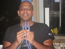
Here is a picture of the end of first pitch, showing off my favorite climbing shoes. Comfy place to hang out.
Almost at the top...
A video taken at the top, taken by one of my friends, and me belaying up the other friend.